Saturday, July 2, 2016

Exploring Bend, Oregon: Cascade Lakes drive


Mt Bachelor, a mere 20-minute drive from Bend, popular year-round


We spent an enjoyable day today exploring the Cascade Lakes Scenic Byway. Described as one of the prettiest drives in the US, the road takes you through a volcanic landscape dotted with numerous lakes, and winds its way through the Deschuttes Forest. 
As we discovered, this particular area is also a very popular recreation area where folks flock to have outdoor fun. We saw numerous cyclists, cars with kayaks and tubes on their roof racks, cars pulling boats, cars pulling campers, and on this summer weekend, there were people everywhere enjoying the pristine wilderness. 

Our first stop was the newly completed Welcome Center, always a worthwhile first stop to gather information from the helpful rangers about where to go and what to see. Here, we also found out more about the geology of the area. Oregon and its mountain ranges were created through a collision process that has taken over 150 million years, during which lava reached the earth's surface resulting in the numerous volcanic peaks that dot the landscape. Basically, this region lies on the North American continental plate that is slowly drifting southwest and colliding with the Juan de Fuca oceanic plate moving northeast.  

The first people who frequented this region are the Native American tribes: the Warm Springs, Paiutes, and Klamath. They followed animal migration paths in search of food and water in the high country. The Paiutes typically lived in southern Oregon and northern Nevada and moved frequently following game. They camped in central Oregon to hunt and gather food. The Klamath preferred to fish and gather pond lily seeds (wocus) as their primary food source. The Warm springs lived along the Columbia River and its tributaries including the Deschuttes River. They traveled to areas in southern and central Oregon to hunt and gather food. 
By the mid-1800's, with the influx of white settlers, these indigenous tribes were displaced from their lands to reservations. The Treaty of 1855 was created to protect their sacred places and restore their cultural connection to their ancestral lands. 

Following the suggested route by the ranger from the Welcome Center, we continued on, along route 46, marveling at the diversity of the scenery.


Broken Top ahead with one of the three Sisters on the left
tell-tale signs of  ancient volcanic activity
Sparks Lake was our first stop. We were surprised at the number of cars lining both sides of the dirt road leading up to the lake, and the number of tents and campers set up in every available nook between trees. And no wonder, with such gorgeous scenery all around.
gazing across to Mt Bachelor
Sparks Lake is an obvious choice for canoers, kayakers, and anglers. 
We continued on to the next lake, passing evidence of previous volcanic residue - 

A helpful reader board provided more information about how this region was formed and why it is that certain areas have a golden colored soil. I was fascinated to learn that a volcano erupted below an ice sheet. The power and force of such an event is mind-boggling.


Our next stop was Devil's Lake, which was the most incredible blue-green color, and so clear that you could see the bottom. Once again, cars lined the road and folks camped out in every available nook, picnicking and enjoying the water.

Next along the route was Elk Lake. We had difficulty finding a spot to park. The lake, the campground, and the adjoining resort were mobbed on this hot day. Families were out in droves, and they were clearly enjoying themselves.


We enjoyed a welcome ice-cream and Michael posed with the elk at Elk Lake.


Michael ogling this little beauty, small enough to find a parking spot
 between trees at congested Elk Lake
From Elk Lake, we moved on to Lava Lake for a quick stop and photo. We watched a paddle boarder launch her board, climb on top, and paddle away. Surrounded by a chain of perfect mounds, this too is a beautiful spot, peaceful and tranquil, despite its explosive origins.


According to the ranger, we had completed the prettiest section of the byway, so after Lava Lake, we connected to Route 40 which took us through densely covered forest and eventually through Sunriver and back to Bend. 
We were glad to return "home" to Alpine and relax at our campsite, under the tree, after a successful day of sightseeing and lake hopping. Bend, in the middle of the Oregon high desert, continues to attract folks as a place to live and raise families. Today, we experienced the attraction. It is an outdoor paradise offering any number of activities from boating to cycling, hiking, and camping. Judging by the number of people we saw today, it seemed like most of Bend found their own little spot of wilderness to have fun and enjoy the great outdoors. 

Friday, July 1, 2016

Exploring Bend, Oregon: Tumalo Falls

After the NoWACA rally ended on Thursday morning, we drove the short distance to Scandia RV Park in Bend. Michael's sister and nephews live in Bend, so we stayed on to visit them and to enjoy the 4th of July long weekend together.
We have on previous visits toured several areas while in Bend. This time we explored other areas on our own.


first glimpse from the parking lot
Tumalo Falls was great. We didn't know what to expect and were surprised at the stunning view and height of the falls. The Tumalo Creek spills over an 89-foot drop, creating an almost solid white ribbon that continues along its merry way into the Deschuttes River.


A short steep climb takes you to a viewing point right above the falls for more stunning views.
on the way up to the top 
closer still
overlooking  the top of the falls as the water rushes and spills over the edge
the stream rushing towards the lip of the falls before
plunging down 89 feet
Tumalo Creek bubbling along towards the Deschuttes River
Located on Forest Service land, the falls are located about 20 miles from Bend. The road looks like it is newly paved, and takes you through pretty forest. The last couple of miles are rough gravel road. 
20 miles along Skyliners Road, heading towards the turn-off to the falls
in a few areas you drive over washboard road


peek-a-boo glimpses of Tumalo Creek along the gravel route

Thursday, June 30, 2016

NoWACA 10th Anniversary Rally

Alpine and Jeep, site 17
The Bend-Sisters Garden RV Resort is a great gathering spot and a well-appointed resort, close to both towns

Thirty-five Alpine coaches converged and looked quite awesome lined up side-by-side. 
pretty lake and pretty skies at the Bend-Sisters RV Resort
We had a great time celebrating 10 years of NoWACA rallies: 
  • gathering under the big tent for meals and meetings
  • spending time with old friends and making new ones
  • eating far too much thanks to the wonderful meals prepared by our hosts
  • chatting and laughing a lot
  • exchanging travel experiences and making notes about future spots to investigate
  • playing games, exploring the area, and generally having fun

Our rally hosts, once again, out-did themselves, hosting a memorable gathering. As a memento of the anniversary, each coach couple was gifted with a handmade bag to carry our utensils and plates, featuring the NoWACA logo. 
four "crafty"  NoWACA seamstresses sewed a bag for
each couple, with a name tag, and separate outside
pocket to hold utensils  - these are very handy to carry
our table setting to our meals

We look forward to future rallies with our home-territory group. The NoWACA Alpine family keeps on growing, and we welcomed three new couples and their new-to-them coaches. One first-time attendee couple were hooked on the first evening and during the introductions declared they were having so much fun that they were already looking forward to the next rally. NoWACA folks rock!
gathering under the tent
Patty (AKA Flipper) flipping pancakes, with Beth


Sunday, June 26, 2016

The road to Sisters, Oregon

Our next stop was Sisters Garden RV Resort for the NoWACA Rally. To get to Sisters, we followed Route 1 south from Cape Kiwanda, connected with Route 18 east, then Route 22 through Salem. The road took us right through downtown Salem, which appeared to have expanded a lot since we were last there 35 years ago. Past Salem, we continued heading east towards the Cascade Range, following the Santiam River and Detroit Lake recreation area, enjoying the scenery and a route new to us. We crossed Santiam Pass (elevation 4,817 Ft), and continued along Route 20 into Sisters. We had perfect traveling weather.
heading towards the Cascade Range beyond Salem
following the Santiam River
Detroit Lake, above Detroit Dam, obviously a popular spot
one of many volcanic peaks along the route, possibly Mt Jefferson
Santiam River
once we crossed the pass, the terrain changed to be more scrubby and dry, with
occasional lava beds from past eruptions
evidence of new growth after the fierce fires from a few years ago


Three Fingered Jack (I believe) - it would be more helpful
if the peaks had signs identifying them;)
Hoodoo Butte 
driving through the quaint little downtown of Sisters

Saturday, June 25, 2016

The pictures tell all...


Our stay was terrific.We happen to like this spot we now call our Northwest Pismo Beach.

Except for one rainy day, the weather was perfect. And by day's end during the one rainy day, the clouds cleared in time for a long beach walk after dinner. The sun goes down late in summer extending our days just that little longer.
view south towards the rock and the gigantic sand dune and cliffs
view east beyond the beach
rock pools at the base of the cliffs
view south from the top of the cliffs
view from the cliffs and on the other side of the haystack
just another perfect day at Cape Kiwanda
there are families of black bunnies that share the camp ground with us humans
and are a never ending source of amusement for the little ones who love to
watch them and chase them

Sunday, June 19, 2016

Off again

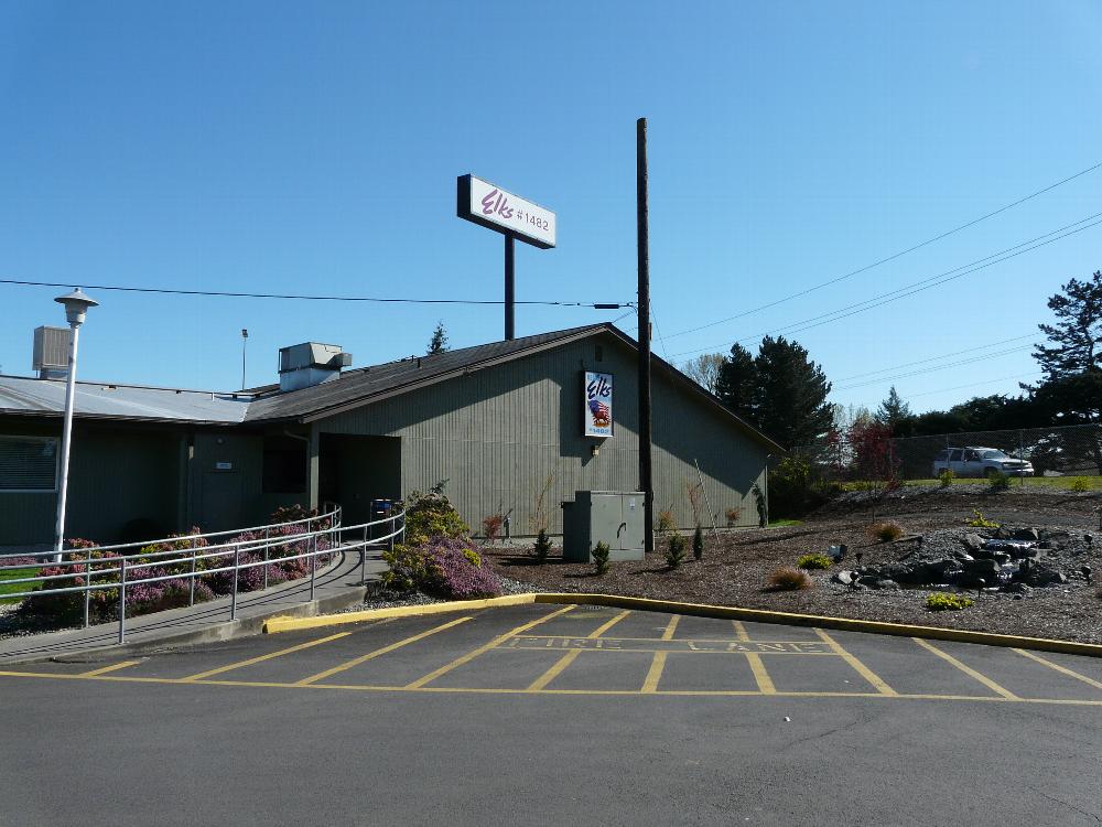
We left Bellevue on Saturday and our first overnight was at the Kelso/Longview Elks. It was a convenient stop and most welcome after a miserable drive through heavy traffic and torrential downpours in spots along the I-5 corridor. 
There are 13 level drive-through RV sites with electric & water hookups, and a dump station. Our site was just long enough that we were able to leave the Jeep hooked up. The lodge itself is conveniently located next to a mall and a Safeway. That evening, there was a private anniversary party but later when we popped in to have a drink, we were welcomed to sashay with the others around the dance floor. Did someone say there would be music and dancing?! 

Sunday morning, we continued on to Cape Kiwanda RV Resort, where we will stay for the rest of the week. Cape Kiwanda, close to Pacific City, Oregon, has become our Northwest "Pismo Beach." 

We took a route new to us. From Portland we drove west along route 8, then joined route 6 which takes you to the coast through the Tillamook Forest and along the Wilson River. The scenery was pretty, first past verdant fields and then winding its way along the river.
At Tillamook we joined coastal route 101 for the short drive to Cape Kiwanda.  
fields and forests along route 6
approaching the Tillamook Forest
rounding a corner for our first sighting of Kiwanda's haystack rock
the back side of the high, steep sand dune
back at his favorite Oregon beach
site 15

Here we will stay for the remainder of the week, happy to enjoy our daily beach walks and sunsets. At some point we will attempt to scale the gigantic sand dune to the very top and run back down again. 
And we have plans to meet up with the Wynns at the end of the week in Albany at the FMCA rally and industry convention.